The data platform for fish and wildlife biology
Bring your data in from the tools your crews already use, or collect it directly in CensusIO. Either way, CensusIO validates it, turns it into reports and range maps, keeps it in one place that lasts, and clears the mess that comes after.
Two ways in, one place for the data
One survey-type engine powers both. The same definition that validates an import also renders the collect-direct form.
Import from the tools you already use
ArcGIS Field Maps, KoboToolbox, ODK Central, or a spreadsheet. Connect a source or drop a file, and your data lands validated and mapped. Nothing about your field workflow has to change.
Collect directly when you have no other tool
A first-party collect-direct app, now in development, lets a biologist enter observations straight into CensusIO with no import step. It is offline-first, built for intermittent connectivity, so it works in the field and holds through the gaps.
Collect-direct
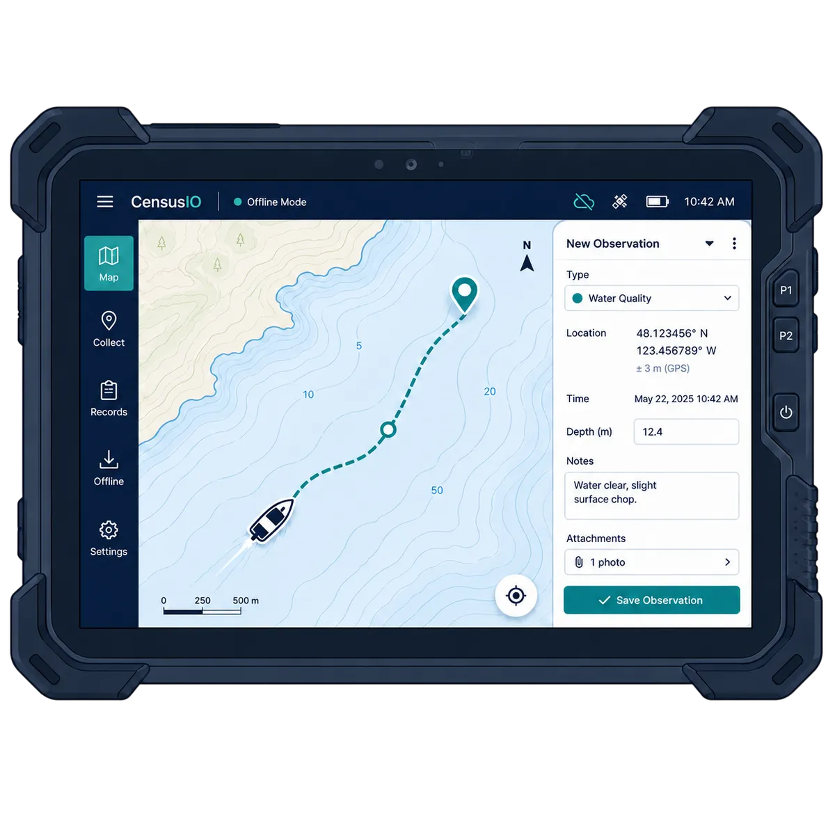
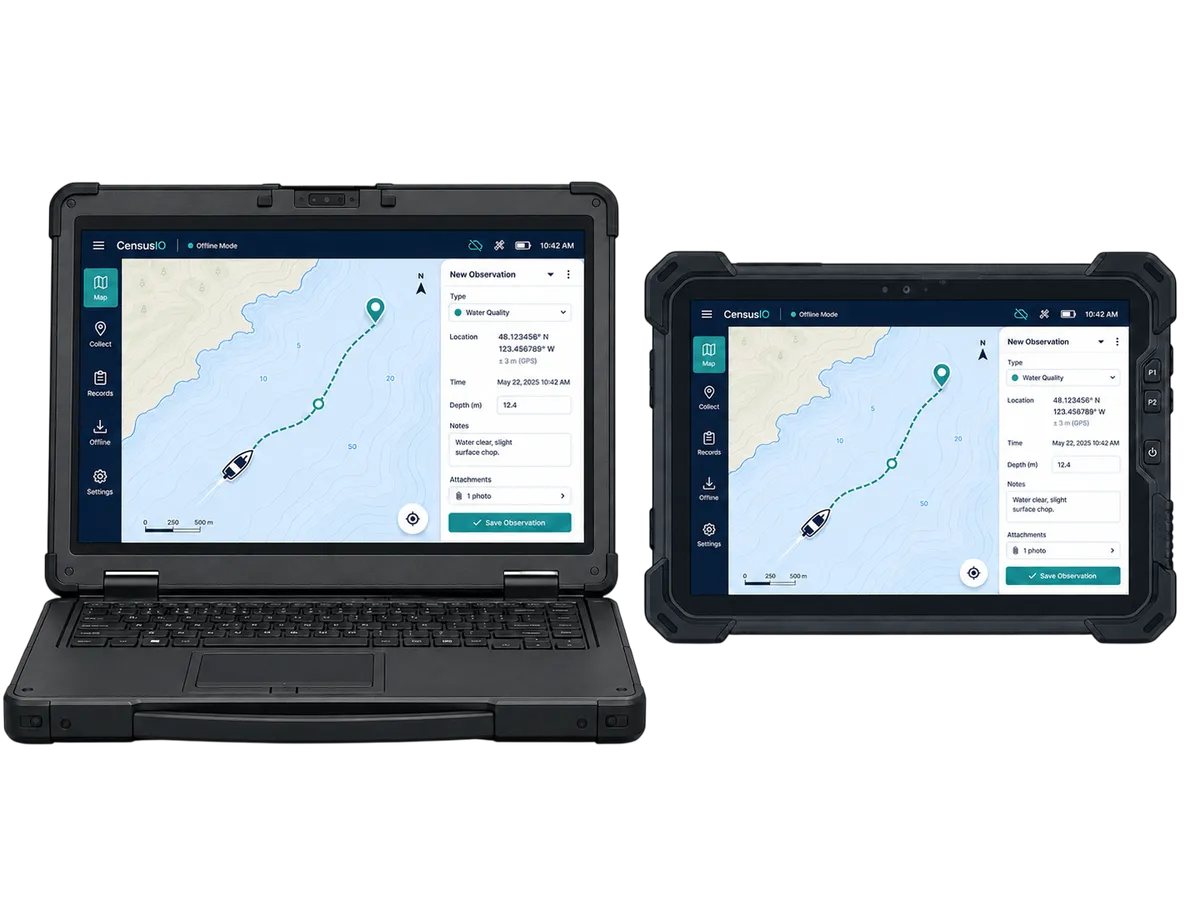
Built for the field, online or off
CensusIO runs in the browser on rugged tablets and laptops. Capture observations with no signal, hold them on the device, and sync to CensusIO the moment you reconnect. The desktop, Android, and iOS apps are all available now.


AI-assisted collection
Capture more, type less
Tally fills the form while your hands are full, and the camera measures, counts, and reads tags from a photo. AI drafts and suggests; you confirm every value before it is saved, so the record stays yours.
- Fill a form by voice, hands-free, with each answer read back to confirm
- Measure length from a photo, with a reference card or printed marker
- Count a tray of specimens from a photo
- Scan a tag or barcode to log a specimen
On the way: species suggestions from a photo, reading printed labels, and photo field-value hints.
It works the same in any browser, on the desktop app, and on mobile.
Reporting that is not an afterthought
Built-in biological reports and a custom report builder. Catch per unit effort, length-frequency, harvest summaries, range maps. No per-report charges, no credit meter.
Define your own survey types
Add a new kind of survey yourself, without waiting on IT. The structure you define validates incoming data and produces clean records.
Standards-aligned exports
Darwin Core Archive with EML metadata, Humboldt Extension survey reporting, and GBIF-ready output. Your data is never trapped in one vendor format.
Flat, predictable pricing
Free for individual researchers. Clear annual tiers for councils, consultancies, and agencies. No surprise charges to put in a grant work plan.
AI analysis
Report summaries you can trust
Ask for a plain-language summary of any report. CensusIO gives the model only the numbers your reports already computed, so it does not invent figures, and every summary is a draft your team reviews before it is used.
- Grounded in your validated data, with no invented numbers
- A person reviews and signs off on every summary
- Use the built-in model, or bring your own key
- Keep data in region when your policy requires it

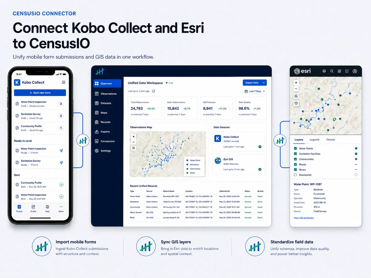
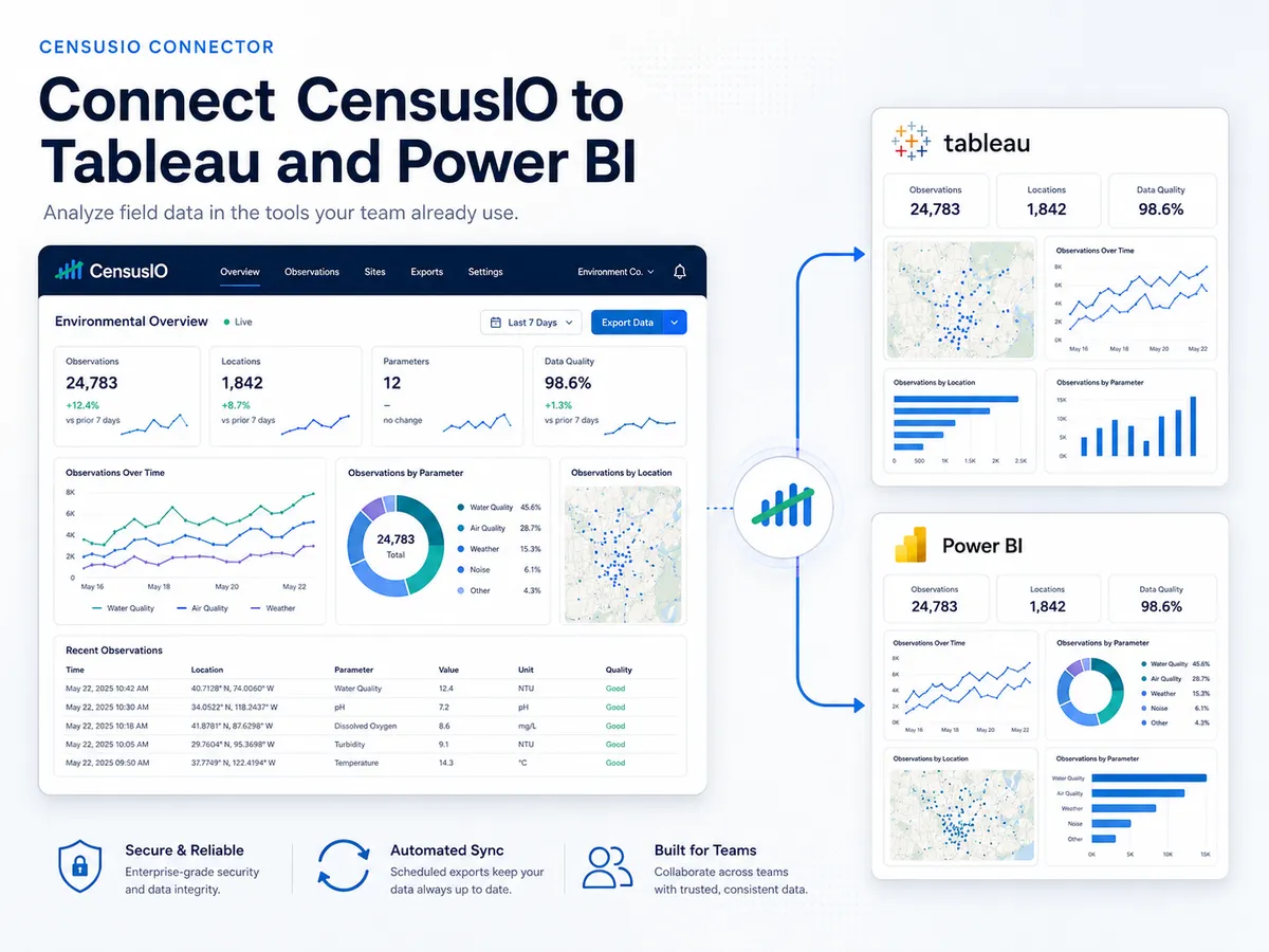
Works with the tools your team already uses
Pull field data in from KoboToolbox and Esri, and push it out to the analytics tools you already run.